Turncarver
A Photo Journal
V2_2609031654
September 2015: Tin Can Gap
On Labor Day weekend, some friends and I decided to explore the Three Fingers trail
I hiked with Jim in 1998. Due to the added time required for bicycling to the
trailhead, we elected to hike only as far as Tin Can Gap.
In the years since Jim and I hiked the trail, the road
was closed due to flood damage. The road closure is at the bridge over the South
Fork of Canyon Creek, about 8.5 miles from the trailhead, where large rocks have
been placed to prevent access using motorized vehicles. Foot and bicycle
traffic is allowed on the road; bicycles are now the preferred means to access the trailhead.
The road to the trailhead is an easy 8.5 mile ride. The grades are gentle, and roadbed
is in good shape. In the years since the closure brush has encroached on the
road. In some places it feels like single track, with brush so close to trail
it touches the rider’s shoulders. Because the roadbed was packed and maintained
for cars, the trail surface is still firm, with very little water damage or ruts. The
trip down after the hike is great end to the day - fast downhill (one easy climb)
with enough opportunities to peddle gently that it helps relax the legs after the hike.
The trail,
which was rough when Jim and I hiked it, is rougher now. The section below
Saddle Lake contains many rocks, tree roots, and fallen trees blocking the
trail. Its slow going, but the old growth forest is nice. Above Saddle Lake
the trail gets a little better, but there are still many rocks and wet spots. As
the trail approaches Goat Flats it opens up and passes through several meadows
containing tarns. Goat Flats is large meadow with panoramic views of Three
Fingers and the mountains to the north. After passing Goat Flats the trail is
a dry rocky traverse followed by a short climb to Tin Can Gap. Tin Can Gap
provides close up views of the Queest Alb Glacier and Three Fingers (we saw v
ery little due to the fog).
We turned around at Tin Can Gap. The trail continues above Tin Can Gap for
a couple of miles, until it ends at the
lookout
on the top of the South Finger. Jim and I climbed to the lookout on our 1998 trip. This
section of the trail is considerably rougher than the trail to Tin Can
Gap. There are several sections which require scrambling and crossing exposed
snow. Good boots are a must; some people take an ice axe. The trail ends at
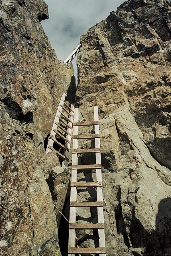
the base of three ladders ascending to the lookout.
Thoughts for Future Trips
- The trail is not steep, but its rough, and very scenic. This makes for slow going. This hike took us more that two and half hours longer than our normal pace for a comparable hike on a “normal” trail.
- The rough trail can strain the stabilization muscles in the leg (e.g., Tibialis Anterior, ) far more that traveling on well-maintained trail. This adds up, and further slows the descent. Our descent took fifteen minutes longer than our ascent.
- A gravel bike or hardtail mountain bike is adequate for the ride.
- Riding up the road with a day pack is no problem, but a luggage rack would be helpful if a heavier (overnight) load is required.
- I road up in bike shorts then changed to hiking pants at the trailhead - I would do it again for the added comfort.
- I carried a garbage bag to keep my bike shorts and helmet dry at the trailhead.
- I carried a handlebar mounted headlight for the bicycle - it would be a lot nicer than a headlamp if we had to ride down after dark.