Turncarver
A Photo Journal
V2_2505151625
Day 3: Trient Hut to Velan Hut
| Trip Date: | 04/20/2016 |
|---|---|
| Weather: | Sunny and warm; no wind |
| Comments: | This day began with a short ski down the Plateau du Trient followed by a short climb up the Col des Ecandies and a ski down the Val d' Arpette to the town of Champex. After a capuccino break in Campex we took a taxi to Borg-St-Pierre. From Borg-St-Pierre we climbed up to the Velan hut. |
| Location | Travel Mode | Ending Elevation (ft) | Elevation Change (ft) | Time of Day | Distance | Time this Leg | Cum Trip Time | Observations |
|---|---|---|---|---|---|---|---|---|
| Trient Hut | Start | 10,376.0 ft | 6:22 AM | |||||
| Ski to base of Col des Ecandies | Ski | 9,049.0 ft | -1,327.0 | 6:52 AM | 1.40 mi | 0:30 | 0:30 | Very icy snow at start, some improvement on the NE Aspect |
| Climb Col des Ecandies | Boots & Crampons, Roped with some fixed lines | 9,170.0 ft | 121.0 ft | 7:18 AM | 0.09 mi | 0:26 | 0:56 | Short, steep climb; mostly snow |
| Ski to Arpette | Ski | 5,381.0 ft | -3,789.0 ft | 8:20 AM | 3.90 mi | 1:02 | 1:58 | Soft snow, breakable crust, frozen snow |
| Walk into Champex | Walk - Road / Trail | 4,861.0 ft | -520.0 ft | 8:50 AM | 1.10 mi | 0:30 | 2:28 | Walk along road (no snow) |
| Cappuccino break in Champex | Stopped | 4,861.0 ft | 9:33 AM | 0:43 | 3:11 | Pastry and coffee in the sun | ||
| Taxi to Borg-St-Pierre | Driving | 5,872.0 ft | 1,011.0 ft | 10:11 AM | 16.00 mi | 0:38 | 3:49 | Taxi ride - NOT INCLUDED IN TOTALS BELOW |
| Hike to snow line | Walk - Road / Trail | 7,022.0 ft | 1,150.0 ft | 11:58 AM | 2.00 mi | 5:36 | HH:MM | Foot path through high pasture (no snow) |
| Skin to Velan Hut | Skin | 8,667.0 ft | 1,645.0 ft | 2:30 PM | 1.70 mi | 2:32 | 8:08 | Minor grade followed by kick turns & ridge walk |
Travel times in this table include, breaks, transitions, etc
| Max Elevation: | 10,376 ft |
|---|---|
| Net Elevation Gain: | -1,709 ft |
| Total Ascent: | 2,916 ft ft (excluding gain during taxi ride) |
| Total Descent: | -5,636 ft | Total Miles: | 10.2 mi (excluding miles from taxi ride) | Total Duration: | 8:08 |
Map (click on image to enlarge / zoom to fit small screens)
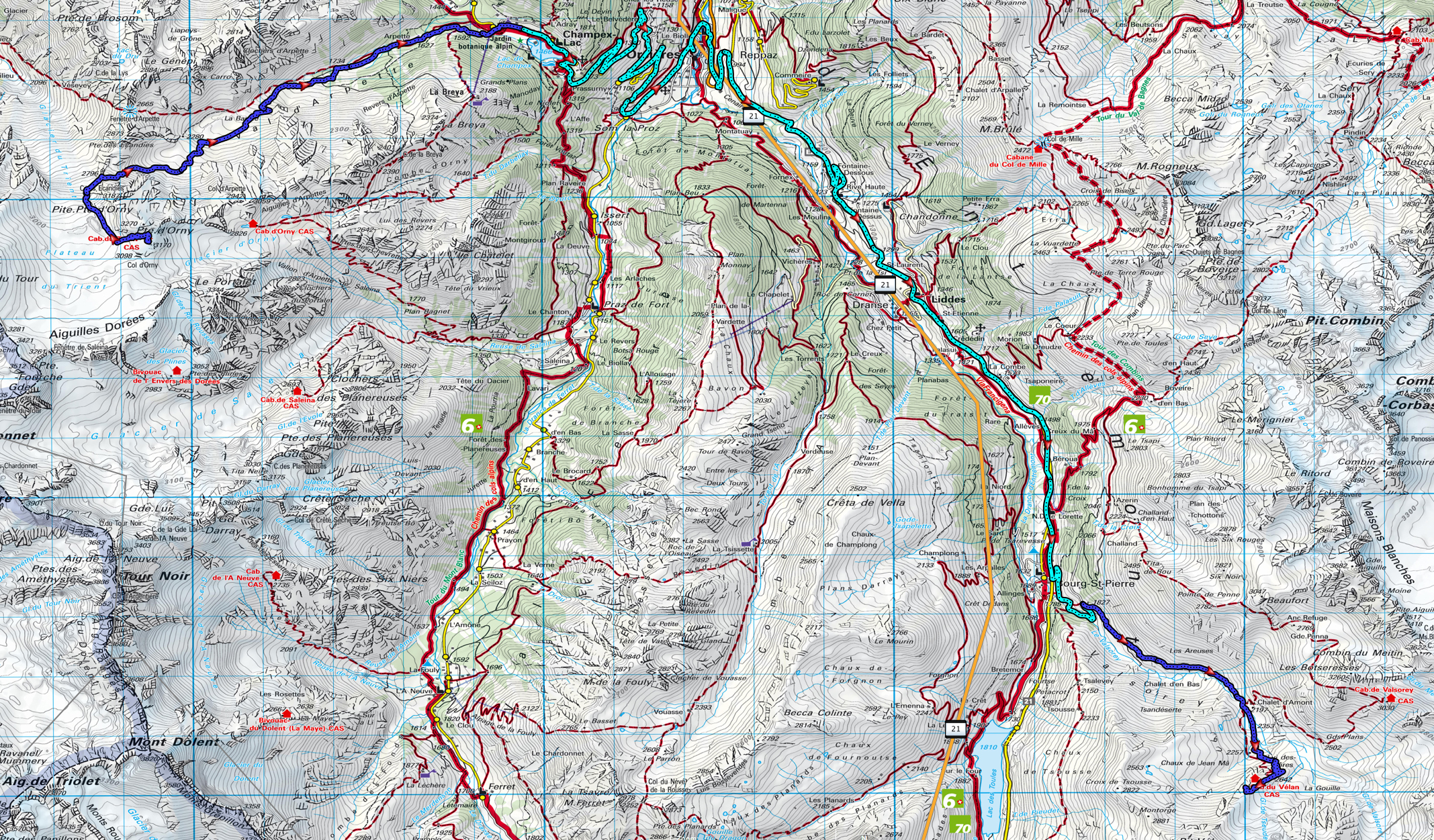
The light blue line traces the portion of the route traveled by taxi
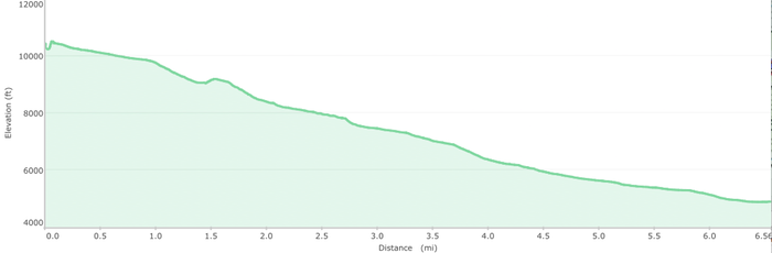
Elevation Profile (Descent to Champex)
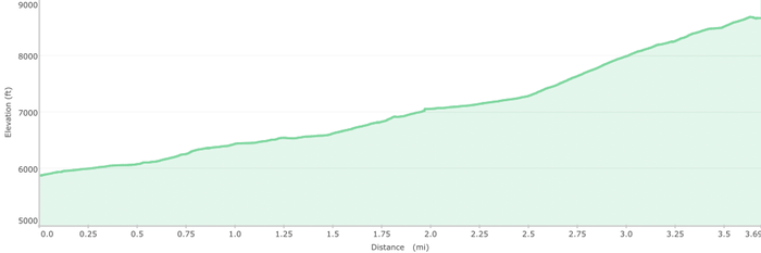
Elevation Profile (Ascent to Velan Hut)
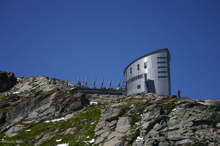
Trient Hut (click on image to enlarge / zoom to fit small screens)