Turncarver
A Photo Journal
V2_2505151625
Day 7: Glacier de Piece to Arolla
| Trip Date: | 04/24/2016 |
|---|---|
| Weather: | Very foggy and snowing (near white-out at the top); about 10 inches new snow the previous day and overnight |
| Comments: | The weather continued to close in. The forecast was for continued bad weather, so we decided to leave the Haute route instead of laying over a day to wait for the weather to clear. (This provided better options for activities the following day.) From the town of Arolla we took a bus and trains to Zermatt |
| Location | Travel Mode | Ending Elevation (ft) | Elevation Change (ft) | Time of Day | Distance | Time this Leg | Cum Trip Time | Observations |
|---|---|---|---|---|---|---|---|---|
| Vignettes Hut | Start | 10,367.0 ft | 7:01 AM | |||||
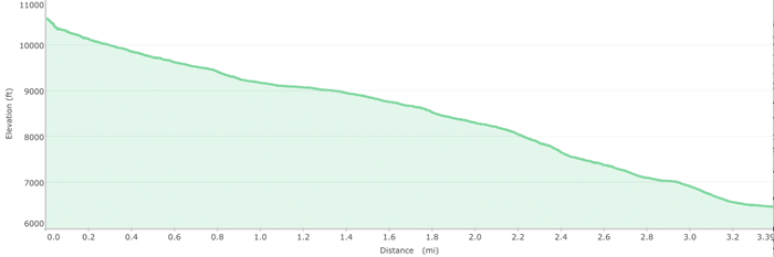
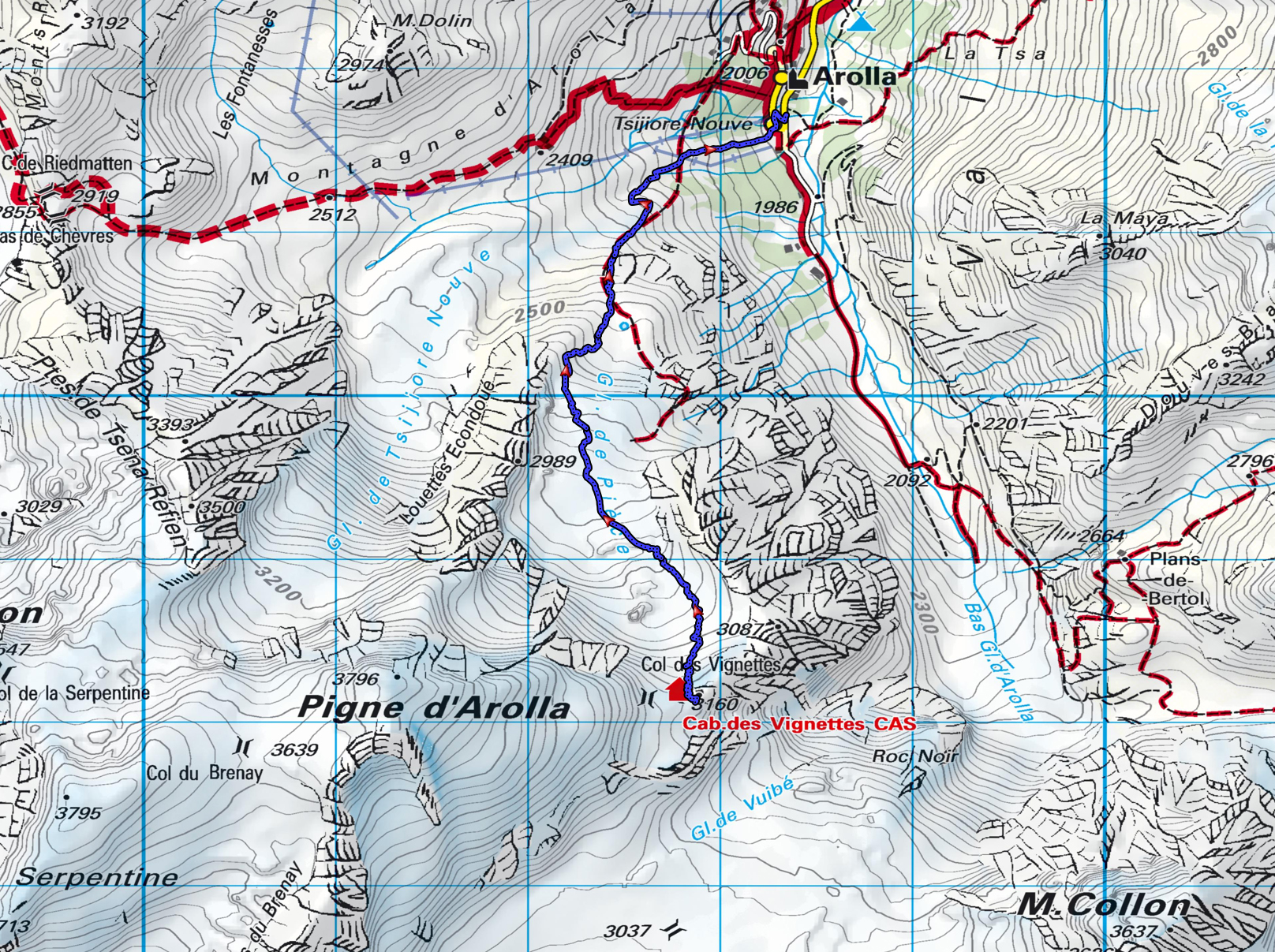
| Ski down Glacier de Piece to Arolla | Ski | 6,458.0 ft | -3,909.0 ft | 8:19 AM | 3.40 mi | 1:18 | 1:18 | Easy ski on nice new snow; exposed rock near the bottom |
Travel times in this table include, breaks, transitions, etc
| Max Elevation: | 10,367 ft |
|---|---|
| Net Elevation Gain: | -3,909 ft |
| Total Total Ascent: | 0 ft |
| Total Descent: | -3,909 ft | Total Miles: | 3.4 mi | Total Duration: | 1:18 |
Map (click on image to enlarge / zoom to fit small screens)
Elevation Profile